Class 6 | SST
Chapter 3 | Landforms and Life
Aligned with CBSE | NCERT | School & Olympiad Standards
Focus on What Matters Most
The67Sprint
⛰️ Mountains, Plateaus & Plains
- Mountains: much higher than surroundings, with a broad base, steep slopes, narrow summit
- Young mountains (Himalayas, Andes) have tall sharp peaks and are still growing; old mountains (Aravallis) are shorter and rounded from erosion
- Plateaus are elevated tablelands rising sharply on at least one side — global "storehouses of minerals" like the Chhota Nagpur Plateau (coal, iron, manganese)
- Plains are flat or gently undulating lowlands, generally under 300 m above sea level, formed by rivers depositing sand, silt and rock
- Some plateaus, like the Deccan, have rich dark soil that is highly fertile and excellent for farming — plateaus are not all barren
🏜️ Deserts & Valleys
- Deserts are large, dry expanses with very little precipitation — can be hot (Thar, Sahara) or cold
- Ladakh, India's own cold desert or "moonland," has rocky terrain and lakes such as Pangong Tso
- Valleys are low-lying land between hills or mountain ranges, often containing rivers, and have historically been vital for agricultural settlements
🏝️ Islands & Coastlines
- India has a coastline stretching about 7,500 km, dotted with coral reefs and scattered island groups
- Lakshadweep Islands (Arabian Sea) are made of coral
- Andaman & Nicobar Islands (Bay of Bengal) are the exposed peaks of a submerged volcanic mountain range
🎭 The Five Tiṇais (Tamil Sangam Poetry)
- Ancient Tamil Sangam poetry classified landscapes into five tiṇais, linking geography directly to occupation and emotion
- Kuriñji = mountains (hunting, gathering); Mullai = forests/pastures (cattle rearing)
- Marudam = agricultural plains (farming); Neydal = coasts (fishing)
- Pālai = deserts (journeying)
Kuriñji 🏔️
Marudam 🌾
Memory Cheat Code
Young = Sharp, Old = Rounded — young mountains like the Himalayas are still growing tall and jagged; old mountains like the Aravallis have been worn smooth by erosion.
Quick Recall — Sprint Facts
Anamudi
Highest peak in South India, in the Western Ghats
Tibetan Plateau
"Roof of the World" — highest plateau, avg. 4,500 m
Ganga Plain
Around 400 million people live in this fertile region
Hundru Falls
On the Subarnarekha River, Chhota Nagpur Plateau
Ladakh
India's cold desert, home to Pangong Tso lake
Bachendri Pal
First Indian woman to summit Everest, 1984
🔑 Key Terms
Altitude
The height of an object or place above mean sea level
Confluence
The meeting point of two or more flowing rivers, often considered sacred in India
Terrace Farming
Cultivation on flat, step-like structures cut into steep mountain slopes
Avalanche
The sudden, rapid fall of snow, ice, or rocks down a mountainside
Cloudburst
A sudden, violent, extremely heavy rainstorm, typically in mountainous areas
Valley
Low-lying land between hills or mountains, often carrying a river
🏆 Olympiad & Challenger Edge
Lava Plateaus: The Deccan's Secret
Plateaus like the Deccan were formed by massive fissures of ancient volcanic activity — cooling basaltic lava broke down over millions of years into nutrient-dense black soil, perfect for agriculture.
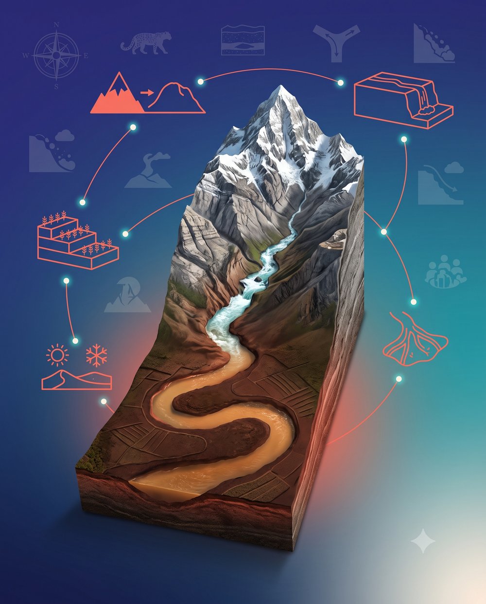
Fluvial Dynamics
In the mountains, rivers flow fast enough to carve deep valleys and carry heavy sediment. On the plains, the flatter slope drops the water's speed, so the river can no longer carry that load and deposits it instead.
Rain Shadow Effect
The Western Ghats intercept moisture-heavy monsoon winds, causing heavy rain on the windward side while the leeward side stays dry — creating very different micro-climates close together.
Sacred Geography
Mount Everest (Chomolungma/Sagarmatha) and Kailash are globally revered as sacred, showing how ancient cultures mapped the world through faith as much as geography.
Old Mountains Are Taller?
Wrong. Young mountains are taller and sharper because they're still growing; old mountains have eroded down and rounded off.
Deserts Are Always Hot?
No. Deserts are defined by low precipitation, not heat — Ladakh is a cold desert right here in India.
Plateaus Can't Be Farmed?
Some plateaus, like the Deccan, have rich dark soil that is excellent for farming.
Ganga Flows Into Yamuna?
Backwards. The Yamuna is a tributary that flows into the Ganga at Prayagraj.
Your Weekend Getaway
Skiing or mountaineering means heading to the mountains; giant waterfalls mean visiting a plateau.
What's On Your Plate
The rice and wheat in your meals mostly come from fertile plains built by river sediment.
The Metals Around You
Iron, coal and manganese in phones, buildings and electricity mostly come from plateaus.
Coastal Life & Islands
Lakshadweep's coral islands and Andaman's volcanic peaks show two very different island origins along India's 7,500 km coastline.
Plains Are Perfectly Flat?
Not quite — plains are gently undulating, and can rise up to 300 m above sea level.
Mixing Up the Tiṇais
Memorize the exact pairs: Kuriñji = Mountains, Mullai = Forests, Marudam = Plains, Neydal = Coasts, Pālai = Deserts.
Lakshadweep vs. Andaman
Don't swap them — Lakshadweep is coral (Arabian Sea), Andaman & Nicobar is volcanic (Bay of Bengal).
Missing the Height Threshold
Forgetting to state plains are "generally not more than 300 m above sea level" costs marks.
Logic Chain
Step 1
Snow melts or heavy rain falls high in the mountains
Step 2
High-velocity rivers rush down steep slopes, eroding rock into sand and silt
Step 3
Rivers reach flat lowlands and slow down, losing the energy to carry sediment
Step 4
Sediments are deposited across the land, building deep, fertile alluvial plains
🦉
Mentor Byte
"Geography is not just about memorizing maps — it's about understanding how the earth beneath our feet dictates how we live. Step outside and identify your own local landform. Ask yourself: why is my town built here? Draw a cross-section of India on a blank paper, starting from the high Himalayas, dropping into the Ganga plains, and stepping up onto the Deccan plateau. Visualize how a single drop of water travels across all three to understand how they connect."
💛 Parent Tip
On your next family trip, whether to hills, a beach, or flat farmland, ask your child to name the landform and guess what job most people there would do for a living.